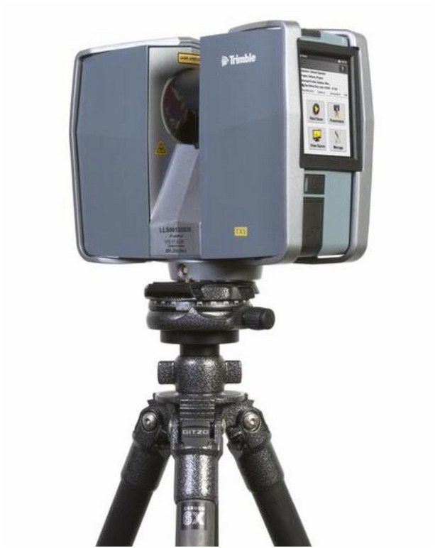
Laser scanning allows us to survey complex structures with a maximum level of detail accurately and fast using the Trimble TX5 scanner and Realworks software.
The TX5 uses a time-of-flight laser to collect a 3D position for anything it comes into contact with creating a “point cloud” for all features around the instrument position. This is a non-contact procedure and is therefore ideal for inaccessible or hazardous areas. From this 3D model we can create detailed AutoCAD drawings from any view including cross sections, elevations and floor plans or 3D models via Revit.
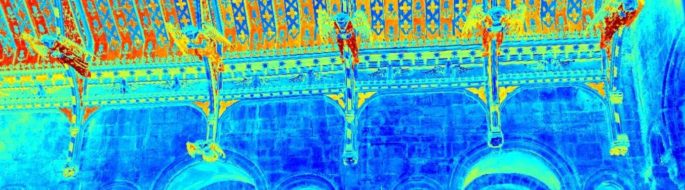
This type of survey is particularly suited to buildings with a high level of intricate details such as listed properties or where a detailed record of the exact layout and design of the property is required for future reference. Because the data is stored electronically it can be accessed at any future time if new or more accurate drawings are needed.
The TX5 can also be used to survey:
- Roads
- Tunnels
- Bridges
- Street scenes
- As-built construction details
- Sea/River defence & control structures
- Archaeological/heritage sites
- Quarries & Mines
- Accident/incident scenes
We are always happy to give demonstrations of the scanner to potential customers please contact us.